Ten pages of images taken while traveling south on U. S. Route 101 along the Oregon coast from the city of Lincoln to Brookings on two different trips: This page includes images from Siletz Bay,
Boiler Bay, and Cape Foulweather. Subsequent pages include images from Agate Beach State Park and Alsea Bay, Cape Perpetua, Ocean Beach, Washburne State Park, Heceta Head, and Heceta Beach, Oregon Dunes, Tahkenitch Lake, Winchester Bay, and North Bend, Cape Blanco State Park and Port Orford, Humbug Mountain State Park and Ophir Beach, Gold Beach and Cape Sebastian, Pistol River and Boardman State Parks, and Harris Beach State Park.
Page 1 of 10
- - - - - - - - - - - - - - - - - - - - - - - - - - - - - -
- - - - - Siletz Bay - Lincoln, Oregon - July 24, 2012 - - - - -
Siletz Bay drift logs and the people exploring them
![[An open expanse of sand land with huge amounts of drift logs. People are walking on the nearby sand and through the logs.]](Photo/Oregon-Coast/Siletz Bay pier.jpg)
Another view at Siletz Bay
![[Rocky foreground has one large rock formation and in the distance are bandss of water and sand and water and sand (due to the bay formation)before reaching the surf of the ocean.]](Photo/Oregon-Coast/Siletz Bay rocks.jpg)
Flower at Siletz Bay
![[At the top of this skinny stem are 8-10 pink-purple blossoms which grow at different heights from the stem such they are stacked atop each other.]](Photo/Oregon-Coast/Siletz Bay flower.jpg)
- - - - - - - - - - - - - - - - - - - - - - - - - - - - - -
- - - - - Boiler Bay - Depoe Bay, Oregon - November 20, 2012 - - - - -
The waves were powerful at high tide on this November day at Boiler Bay State Park. (Watch them crash on the shore.)
![[Two image animation shows wave as it crashed into the rocks and then as the water calmed.]](Photo/Oregon-Coast/wave animation.gif)
Another portion of Boiler Bay State Park
![[Choppy water near the shoreline under grey clouds.]](Photo/Oregon-Coast/Boiler Bay SP.jpg)
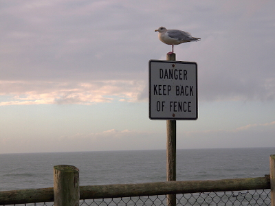
Gulls don't read English, so they stand wherever they want.

- - - - - - - - - - - - - - - - - - - - - - - - - - - - - -
- - - - - Cape Foulweather, Oregon - July 24 (sunny) and November 20 (cloudy) 2012 - - - - -
A small bay north of Cape Foulweather viewed from 500 feet above the sea (according to the sign near the railing).
![[The sunny image is on the left and the cloudy one on the right. Multi-colored blue water is in and around the jut of land which shapes this grass and evergreen tree-covered bay on the left image. The right image has battleship gray water, overcast skies, and the ground is more brown than green.]](Photo/Oregon-Coast/Cape Foulweather - bay side by side.jpg)
Gull Rock, made of basalt and resistant to erosion, is approximately a mile from shore.
![[Looking over the edge of a very sharp drop to the water below. There are whitecaps around several small rocks which are just above the water line. A much larger rock a bit further from shore is the one named Gull Rock.]](Photo/Oregon-Coast/Cape Foulweather - Gull Rock.jpg)
Cape Foulweather (The tip of land in the far right is appproximately 6 miles away.)
![[The sunny image is on top and the cloudy one on bottom. Bother are several images stitched together to show the hillside and the expansive sections of the rocky cape. A number of buildings are visible on the shelf of land above the water.]](Photo/Oregon-Coast/Cape Foulweather stitched side by side.jpg)
Closer view of the far right portion of the prior photos of Cape Foulweather
![[Several images stitched together to show the view from nearby cliff of the multi-pronged landforms creating the bay on the sunny day. This low tide view makes and sand rocks in the water visible.]](Photo/Oregon-Coast/Cape Foulweather.jpg)
Continue to Agate Beach State Park and Alsea Bay photos. (page 2 of 10)
All photos © S. M. Garver